Celebrate The Map: Craftsmanship Meets Innovation
Genuine The Map products handpicked to elevate your everyday life.
The Map: Finding the Magic and Meaning in the Story of Your Life
Rand McNally United States Interstate Fold Map Map – Folded Map, March 1, 2024
2025 Philip's Big Road Atlas of Europe: (A3 Spiral Binding) (Philip's Road Atlases)
Philip's RGS World Atlas (A4): with Global Cities, Facts and Flags
The Map: To Our Responsive Universe - Where Dreams Really Do Come True!
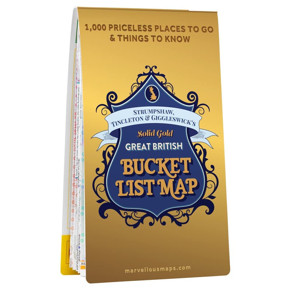
Great British Bucket List Map | Culture & Heritage | Marvellous Maps | Adventure | Long Distance Routes | Historical
Funito Scratch Off Map of The World with Flags - 83 * 60cm Easy to Frame Scratch Off World Map Wall Art Poster with US States & Flags - Deluxe World Map Scratch Off Travel Map Designed for Travelers
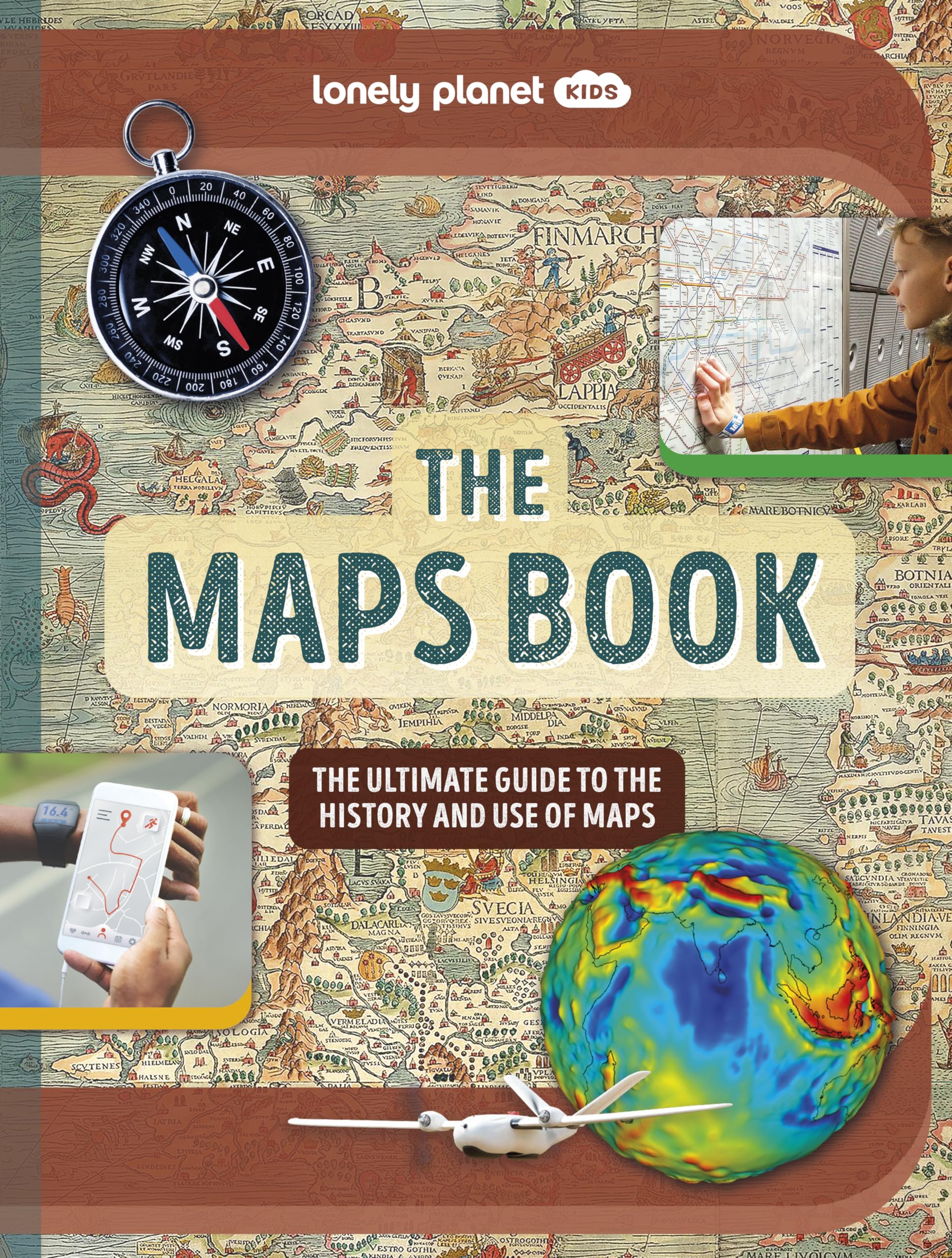
Lonely Planet Kids The Maps Book (The Fact Book)
Collins Children’S World Wall Map: An Illustrated Poster For Your Wall
United States, Southwest Map (National Geographic Adventure Map, 3121) Map – Folded Map, January 1, 2022
Great British Adventure Map | Updated for 2023 | Discover Britain | British Adventure Map & Guide | Holiday Planning | Days Out | British Geography (ST&G's Joyously Busy Great British Adventure Map)
Snowdon / Yr Wyddfa Map | Conwy Valley / Dyffryn Conwy | Ordnance Survey | OS Explorer Map OL 17 | Wales | Walks | Hiking | Maps | Adventure
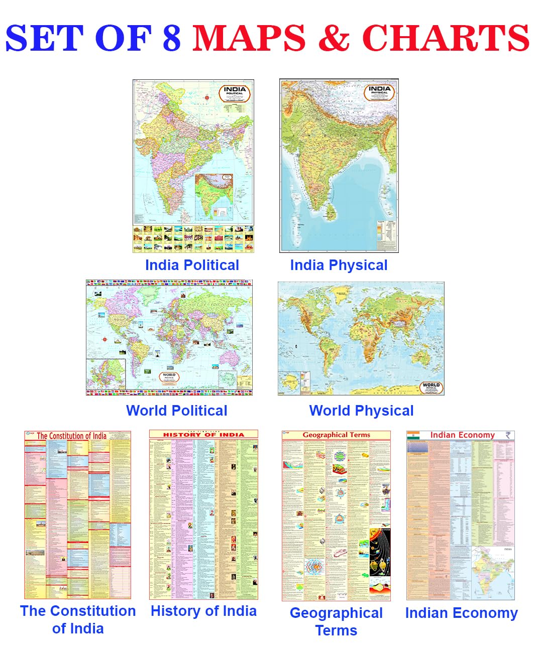
India & World Map ( Both Political & Physical ) with Constitution of India , Indian History , Indian Economy & Geographical Terms Chart | Set Of 8 | Useful for UPSC and other competitive exam preparation | by Hivex Publication
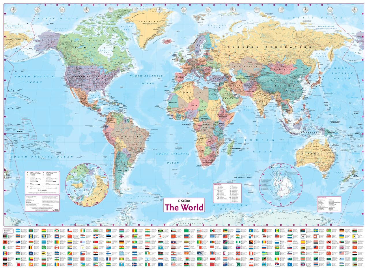
Collins World Wall Laminated Map Map – 31 March 2022
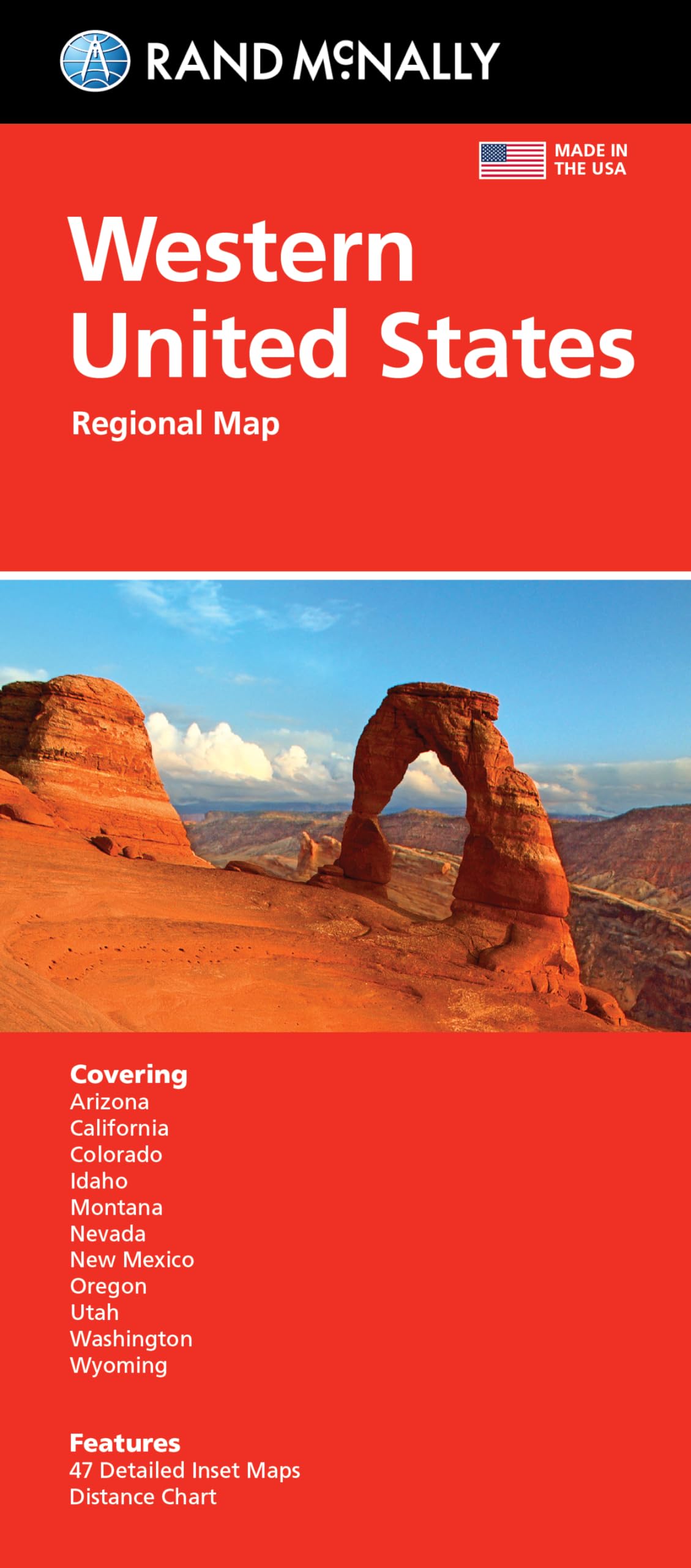
Rand McNally Folded Map: Western United States Map – August 27, 2021
Collins World Atlas: Complete Edition
Collins World Wall Laminated Map
The Map: Finding the Magic and Meaning in the Story of Your Life!
Luckies of London Scratch off Map World Poster, Detailed Map of the World with capitals, states, cities, Scratch Map Deluxe Edition
Great Maps: The World's Masterpieces Explored and Explained (DK History Changers)
Culture map Paperback – Big Book, 21 January 2016
World & India Map (Both Political & Physical) with Constitution of India, Indian History, Indian Economy & Geographical Terms Chart | Set Of 8
Maps International Classic World Wall Map - Map of The World
DAYONG Scratch Off Word Map, Scratch Off Map with Scratcher and Brush, 82x60CM Scratch Off Travel Poster, Travel Map Wall Art Gift for Outdoor Enthusiasts
Lonely Planet Global Limited Europe Planning Map
World Political Marco Polo Wall Map
National Geographic World Map (folded with flags and facts) (National Geographic Reference Map)
Collins Children’s Picture Atlas Hardcover – Atlas, 18 April 2019
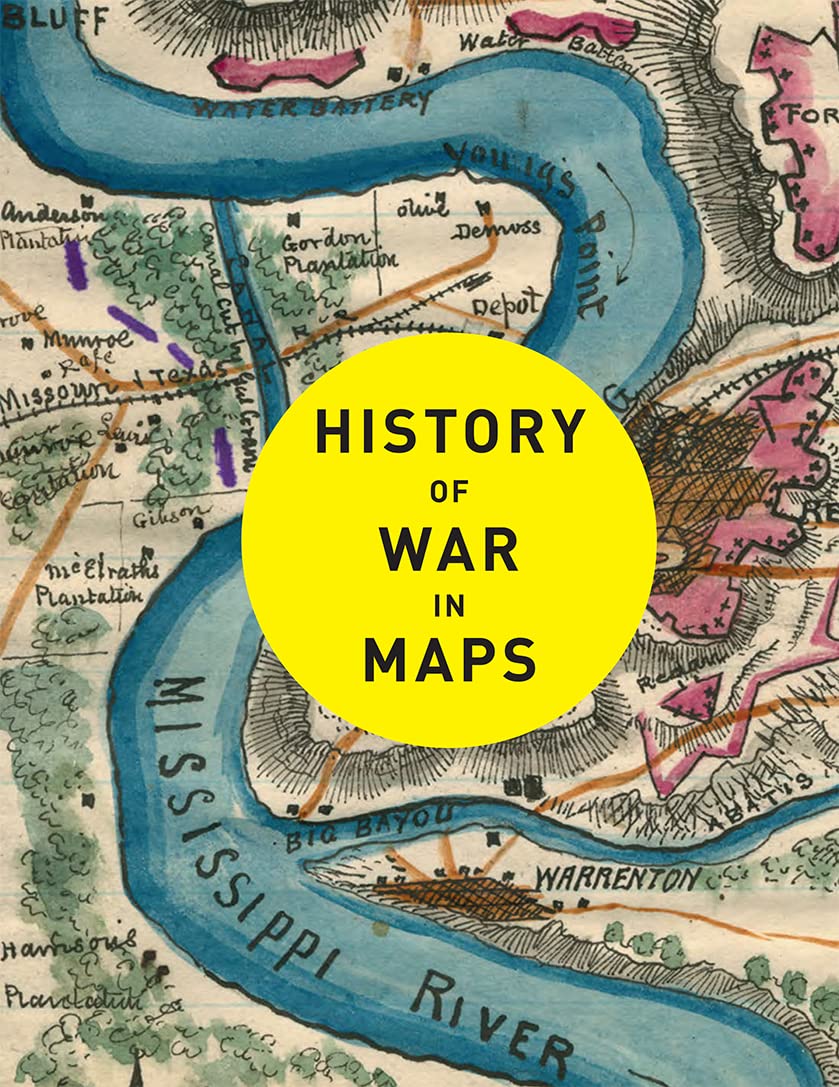
Collins History of War in Maps
Templar Publishing Maps Activity Book
Imagimake Mapology India with State Capitals - Educational Toy and Learning Aid for Boys and Girls - India Map Puzzle - Jigsaw Puzzle, 25 Pieces, Kids
Philip's Handy Road Atlas France, Belgium and The Netherlands: Spiral A5
Lonely Planet Portugal Planning Map
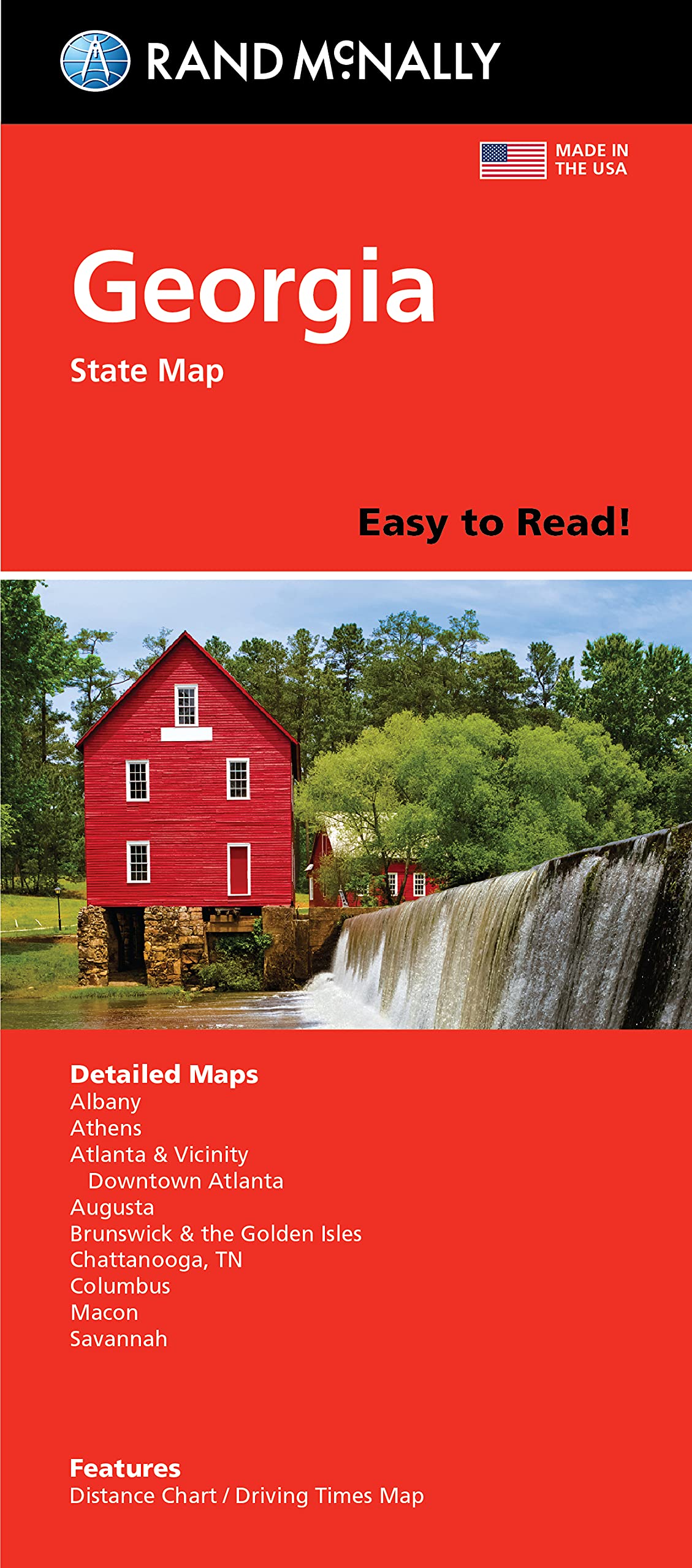
Rand McNally Easy To Read Folded Map: Georgia State Map
India and World Political Map - LAMINATED | Size - 70×100cm | India Map | World Map Unknown Binding – 30 December 2021
India & World Map ( Both Political & Physical ) with Constitution of India Chart, History of India Chart & Geography Terms Chart | Set Of 7 | Useful for UPSC and other exams | By VCP Product Bundle – Folded Map, 1 January 2021
KASTWAVE Tapestry World Wall Map Mural, Decoration Vintage World Map Hanging Poster for Kids Student, Art Educational Background Wallpaper Wall Hanging for Living Room Home Office (39.3 x 59'' M)
Imagimake: Mapology India and World Maps with Capitals - Learn Capitals and Country Flags - Educational Toy for Kids Above 5 Years, Multicolor
Imagimake Mapology World Flags & Capitals Jigsaw Puzzle |75 Multi-Colored Country-Shaped Pieces | Birthday Gift for Boys and Girls| World Map Puzzle | Educational Toys for Kids 5,6,7,8,9,10
World Map Wall Chart – 1 July 2008
Maps of Meaning: The Architecture of Belief 1st Edition
Rand McNally Folded Map: Los Angeles Street Map
ORFOFE Wear-Resistant World Map Poster for Kids - Educational Preschool Cognitive Learning Sheet - Random Style Children's Household Decor
Collins World Atlas: Paperback Edition
PREMIFY 200pcs National Flag Push Pins for Board | Thumb Tacks With World Travel Map Cork Board Set | PushPins for Notice Board, Bulletin Board, Map, Office
ECVVWorld Globe Political Map Globe - English Map - Educational|Geographic|Modern Desktop Decoration - Stainless Steel Arc And plastic Base - School, Home,Office, 18.2cm
Maps International Scratch the World Travel Map - Scratch Off World Map Poster with Gift Tube - X-Large - 84 x 59 cm - - 50 years + of Map Making
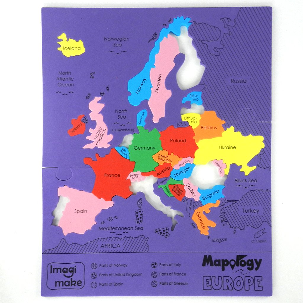
Imagimake Mapology: Europe Map Puzzle
Kids Bedroom DIY Wall Sticker World Map Home Bedroom Room Decor Removable Wall Decal Poster Decoration (Colorful)
The Disney Book of Maps: A Guide to the Magical Worlds of Disney and Pixar
DLT-1616N Colourful World Map Kids Wall Decals Wall Stickers Peel and Stick Removable Wall Stickers for Kids Nursery Bedroom Living Room (XLarge)
Airline Maps: A Century of Art and Design
Plastic Treasure Map Party Accessory (1 count) (1/Pkg)
Modern World Map Digital Hanging Ultra Quiet Acrylic Wall clock Size 156 x 96 cm
Ledes Scratch Off Map of The World Extra Large Size Scratchable Travel Wall Art World Map Poster US States & Country Flags with Scratch Art Tool Vibrant Colors Under Gold Scratch-Off Layer- 32''x23''
Jaffiust 3D World Map Wall Acrylic Material, Creative DIY World Map Modern Home Wall Sculpture for Home Wall Arts Modern Decor (Color : Purple)
Skillmatics World Map Puzzle - 96 Piece Jigsaw Puzzle, Educational Toy, Geography for Kids, 400+ Facts, Gifts for Boys & Girls Ages 6 to 12
History of the World Map by Map Hardcover – Big Book, 23 October 2018
Collins World Wall Paper Map Map – 4 May 2017
Outus Map Tacks Push Pins Plastic Head with Steel Point, 1/8 Inch, 500 Pieces
Tokyo Travel Map Fourth Edition
soying Children Wood World Map Flag Jigsaw Puzzles
PREMIFY 200pcs Creative Push Pins| Different Countries Flags Printed Thumb Tacks |Steel Point for Bulletin Board, Map, Office, Notice Board, Classroom
Lonely Planet Thailand Planning Map Map – Folded Map, 13 July 2018
ImagimakeMapology World- World Map And Its Countries- Learning Aid & Educational Toy- Jigsaw Puzzle- For kids Age 4 and Above
World Decorator, Laminated: Wall Maps World
Maps International - World Map - Updated 2024 - Front Sheet Lamination - 118.9cm (w) x 84.1cm (h)
Maps International World Wall Map - Map of The World Poster - Front Lamination - 47 x 33
Yorkshire Dales Map | Southern & Western | Ordnance Survey | OS Explorer Map OL2 | England | Walks | Hiking | Maps | Adventure: OL02
The Map of Consciousness Explained Paperback – 20 October 2020
Lonely Planet Venice City Map
Maps: Aleksandra Mizielinska - Daniel Mizielinski
India Map : Political | Laminated Both Sides | 70 x 100 cm ( Big Map )
UK Map - Classic Wall Map Of The United Kingdom Poster - Front Lamination – A1, 84 x 59cm
Imagimake Mapology India Map with Flash Card| Swipe & Reveal Card Game | Educational Toys for Kids 7+ Years | Kids Learning Toys | Puzzle Game for Kids 7 to 10 Years | Birthday Gift for Girls & Boys
India & World Map ( Both Political & Physical ) & Constitution Chart | NON LAMINATED PAPER FOLDED MAPS | SET OF 5 | Useful for UPSC, SSC, IES and other competitive exams
National Geographic Maps: World Executive Wall Map - Poster Size - Antique Style - 91 x 61 cm - Folded Map
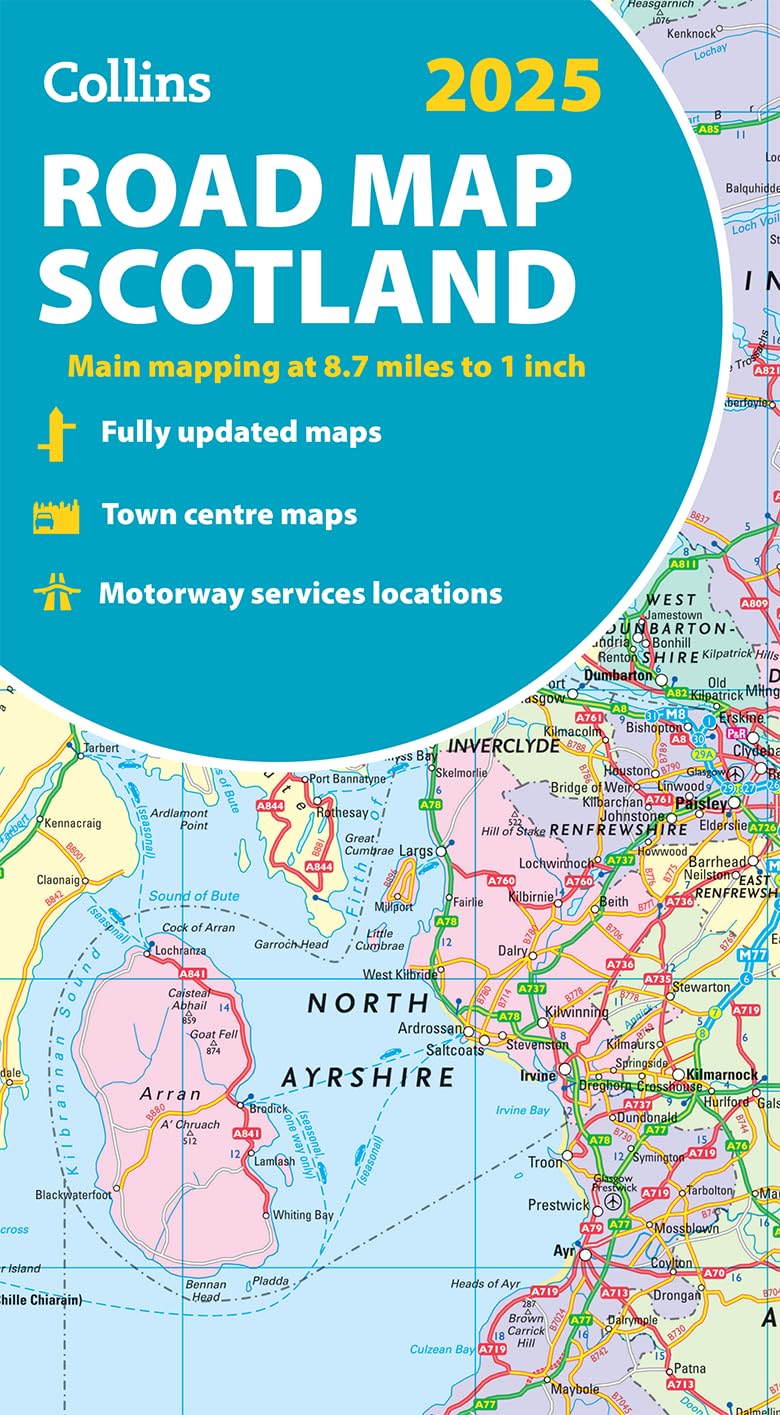
2025 Collins Road Map of Scotland: Folded map (Collins Road Atlas)
Imagimake Mapology Physical Features of World Map | 3D Puzzle & Construction toys for kids | Birthday Gift For Girls & Boys Ages 5,6,7,8,9,10,11,12 | DIY Science Kit for kids
School Student World Atlas Map Book English Latest Edition from InIkao
Capsceoll World Map Wall Tapestry, Wall Hanging Decor Wall Art Hanging Dorm World Map Large Wall Map Cool World Map Decorative Wall Art Travel Wall Decor 80X60 Inches,Black Red
World pol. flat laminated Toy – 20 Dec. 2017