
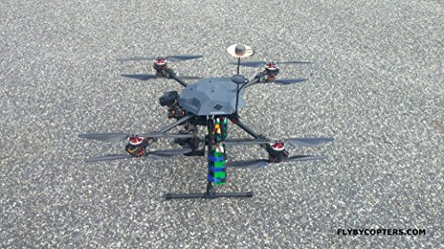
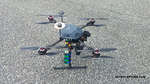
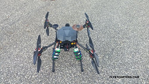
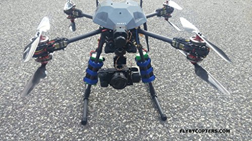

Thermal Surveying/Mapping X8 336 Quadcopter Drone With RTK Multi GNSS GPS
Description
- Pixhawk 32bit AutoPilot Flight Controller
- RTK Multi GNSS GPS
- 3 Axis 32bit Brushless Gimbal
- Flir Vue Pro 336
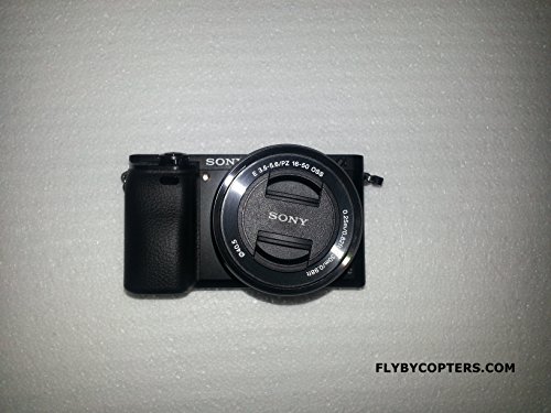
- Sony A6000 High Resolution Camera
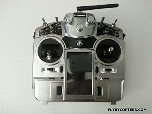
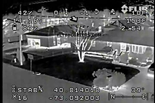
This surveying/mapping thermal imaging quadcopter drone is fully configured out of the box and is capable of autopilot flight with waypoints and RTL. The TX comes configured with six flight modes and 2 channels control the yaw and pitch of the gimbal. With the included Sony A6000 camera you can take professional aerial photos for surveying, mapping and geotagging images. The included thermal sensor automatically geotags the images it takes. With the included ground station, you can easily create an autopilot mission to survey a piece of land. The ground station also features software to easily geotag aerial photos. This drone offers high precision centimeter accuracy multi-GNSS RTK GPS units. The multi-GNSS RTK GPS has accuracy up to 2cm. The hand-held transmitter gives you remote access to the both cameras' shutter via a switch. The included telemetry radio and OSD will transmit live flight data to the included 7" FPV screen and overlay it onto the live video feed from the Sony A6000 or Flir Vue Pro 336. Switch between the video feed from the Sony A6000 and the thermal sensor via the transmitter. Package Contents you will receive: RTF 650mm X8 QuadCopter Carbon Fiber Frame: Auto Pilot Flight Controller: Ublox Neo M8T multi-GNSS RTK GPS Units: Ublox M8N GPS Unit: External Compass: 2.4GHZ 10ch Telemetry TX & RX: Sony A6000 Camera with 16-50mm Lens: Flir Vue Pro 336 Thermal Sensor: 7" 5.8ghz Diversity DVR FPV Screen: Live Video Downlink OSD (On Screen Display): 3 Axis 32bit Brushless Gimbal: 915MHZ 3DR Telemetry Radio Power Module with BEC -Voltage and Current Sensor: 4pcs 6cell 8000mah Batteries: 8pcs Blheli 30amp High Voltage ESC: 8pcs 5010 Brushless Motors: 8pcs 14*5 Carbon Fiber Props: 200w Rapid Battery Charger: Custom Carrying Case: Surveying/Mapping Ground Station With Multi-GNSS RTK GPS: Instructions & Full Specs: Flight time up to 25 minutes. Please contact us at 631-406-3254 or visit FlyByCopter.com for more info.
Common Questions
Trustpilot
2 weeks ago
3 days ago
