🌍 Measure the world, one plot at a time!
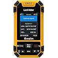
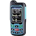
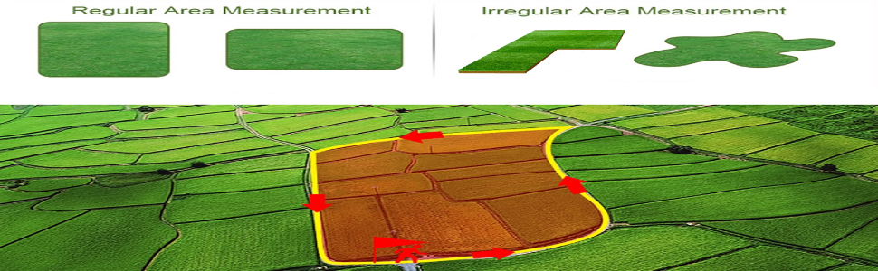
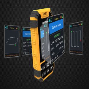
The Professional GNSS Receiver GPS Land Meter is a cutting-edge land surveying machine equipped with a high sensitivity GNSS receiver chip, capable of receiving satellite signals from GPS, GNSS, SBAS, and BeiDou. It features a vibrant color screen that displays critical data such as longitude, latitude, altitude, area measurements, and land price calculations. With 8 versatile area measurement modes and 2 distance measurement modes, this device is designed for both precision and ease of use, making it an essential tool for modern land surveying.

| Item Weight | 8.8 ounces |
| Product Dimensions | 4.61 x 2.4 x 0.87 inches |
| Voice command | Buttons |
W**E
Lousy user-interface and software contains malware
As others has previously stated, the quality of the device is pretty lousy. When running side by side with a much more expensive unit, the results also are not even remotely accurate. The biggest problem is that the software that is burried on the manufacturer's site, contains malware. Upon execution it immediately connects to a server in China, triggering the AV software on my system. Afterwards my systems was acting all kinds of shady.Restored my system from backup and my system is back the way it was, and the GPS unit is in the trash since I allowed the return window to pass.
A**R
repeatability on a fixed piece of property
calibration appears to be simple and the use of the menu.. very easyunfortunately while walking around my property doing an elevation survey of a bottom and a new pond I found the elevation mark moved up and down erratically the grid points stayed very consistentdid find the display to be difficult to read in bright sunlight - the red and blue washes outI think for doing a 'plot' of the property it will work great. I think I spent my money well.
S**E
Accuracy is variable and not much better than phone
The device was easy to set up and offered an acre conversion option. However I could not get consistent results from the device when measuring known points on the ground. It shows 3 decimal place accuracy for seconds, but the reading varies constantly and across different times. I was not able to consistently measure to an accuracy beyond 11m or 33 ft. I could tell that some drift was satellite related, but with 21 satellites working, I still had too much variance to make the device useful for accurate measurements of my property. It may be useful for casual use, but not for putting in fences or measuring property lines.
R**.
No support on product
I bought this item to use out of the country and had to leave right a way. I spent a lot of time researching how to export any data captured. I made several inquiries online with no results. I reached out to the seller and no response. I went on the manufacturer website which had to be translated from Mandarin to English but they show nothing. I am left with a product which works but does me no good without proper instructions on how to export the data. In case you are wondering, the instructions were worthless; among the worst. Do NOT PURCHASE!
B**N
Dont waste your money
Its a cool little deal but it's not accurate and always searching for signal (Time Zone setting is correct)
R**7
Should have use for the American market.
It does not have American distance in feet or yards
Q**Q
?
Not as accurate as I expected. Input the coordinates into my phone and they were off by 50 feet.The free app off of Play Store is within about 15 feetSo. Spent a bunch of money for junk
D**O
Doesn't work with Mac
I really wanted to like this product and get great use out of it. However, the data export only works with Microsoft Windows. Tech support was helpful in confirming this limitation. I can't use the product with this limitation. Without being able to export the data to my Mac, I am unable to confirm accuracy or further usability of the product.
Trustpilot
1 week ago
3 days ago